A land of lava flows and landslips
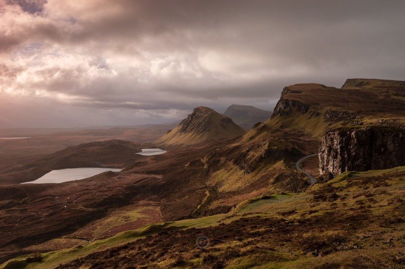
The Trotternish Ridge is Britain's longest and most spectacular landslip. The Storr is the highest point on the Trotternish Ridge (highest point 719 meters) and is a 300 meters thick sandwich of around 24 layers of volcanic rocks formed between 61 and 55 million years ago. It consists of huge volcanic buttresses and basalt cliffs that drop towards the sea, creating a landscape of beautiful und unique rock pinnacles. The 'Old Man of Storr' is the real symbol of Trotternish, and it is visible for 15 miles south and from the north. But there are more pinnacles around, such as the Sanctuary and not far away the pinnacles of the Quiraing. 63-53 million years ago (paleoscene to early eocene epochs (both early Tertiary)) there was volcanic activity on Skye (clearly seen at the Cuillins today) Those Tertiary lava flows on the Isle of Skye were generally only a few meters thick, and attain a maximum of around 35 meters. However, the overall thickness of the flows is great. They are the weathered remnants of what once covered a much wider area. The geomorphology of Trotternish is the result of erosion (past and present), on these Tertiary volcanic lavas and also, in some cases, on the underlying Jurassic sediments. These lava flows caused a landslip, falling away from the weaker Jurassic sediments beneath.
Also in: Scotland
 |  |  |  |  |
 |  |  |  |  |